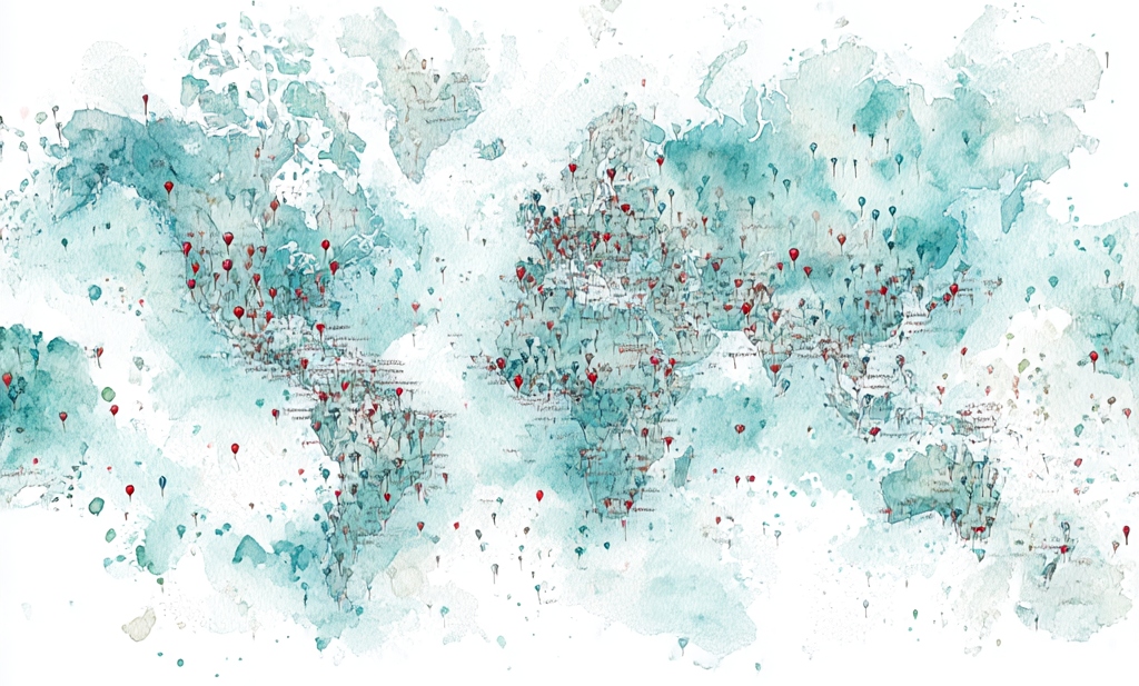
WordPress used to have a widget I loved. I love maps in any case—I’m a certifiable cartophile, and this map I loved in particular. A blogger could put this widget on the side of the page, and its map showed all the countries in which the blog had been read. SO cool.
I can still look up the countries in the blog stats when I want to, so at least the information isn’t lost to me. This week it shows my blog has been read in the United States, United Kingdom, Canada, India, Australia, Pakistan, Germany, Philippines, Singapore, Ireland, France, South Africa, Japan, New Zealand, Sweden, Netherlands, Thailand, Russia, Romania, Spain, Barbados, Mexico, Finland, Bulgaria, Serbia, Portugal, Nigeria, Mauritius, South Korea, Kenya, Italy, Denmark, Switzerland, Belgium, Taiwan, Saudi Arabia, Norway, Israel, Indonesia, and Bangladesh. Holy crap.
Blogging truly is a more global endeavor than you might realize.
But that information is much more fun on a map!
I do love a map, and a paper map above all. I lived in Idaho for my first 45 years, and I had a 5-foot-tall map of the state on one of my walls, complete with all the little Forest Service roads that you need a four-wheel-drive to traverse. I highlighted every road I traveled, and on road trips I planned routes to get the maximum number of new roads highlighted. Some of those were hard-earned highlights, like the road we took out of the mountains above Sun Valley. I had to disengage my fingernails from the upholstery, after all of its narrow turns and curves and drop-offs, with gouges carved out of the road by water—and when we reached the bottom, we had to dig ourselves out of a spot where a beaver dam had flooded and muddied the road. It was only on the back side of that road that we spotted the sign: “Passenger cars not allowed.” (Oops.) My little Subaru 4×4 earned its stripes on those back roads, and so did I.
When we moved to Oregon I bought an Oregon atlas—the whole state divided into detailed quadrants, with all those little back roads—and got out my highlighter again. A new state to explore!
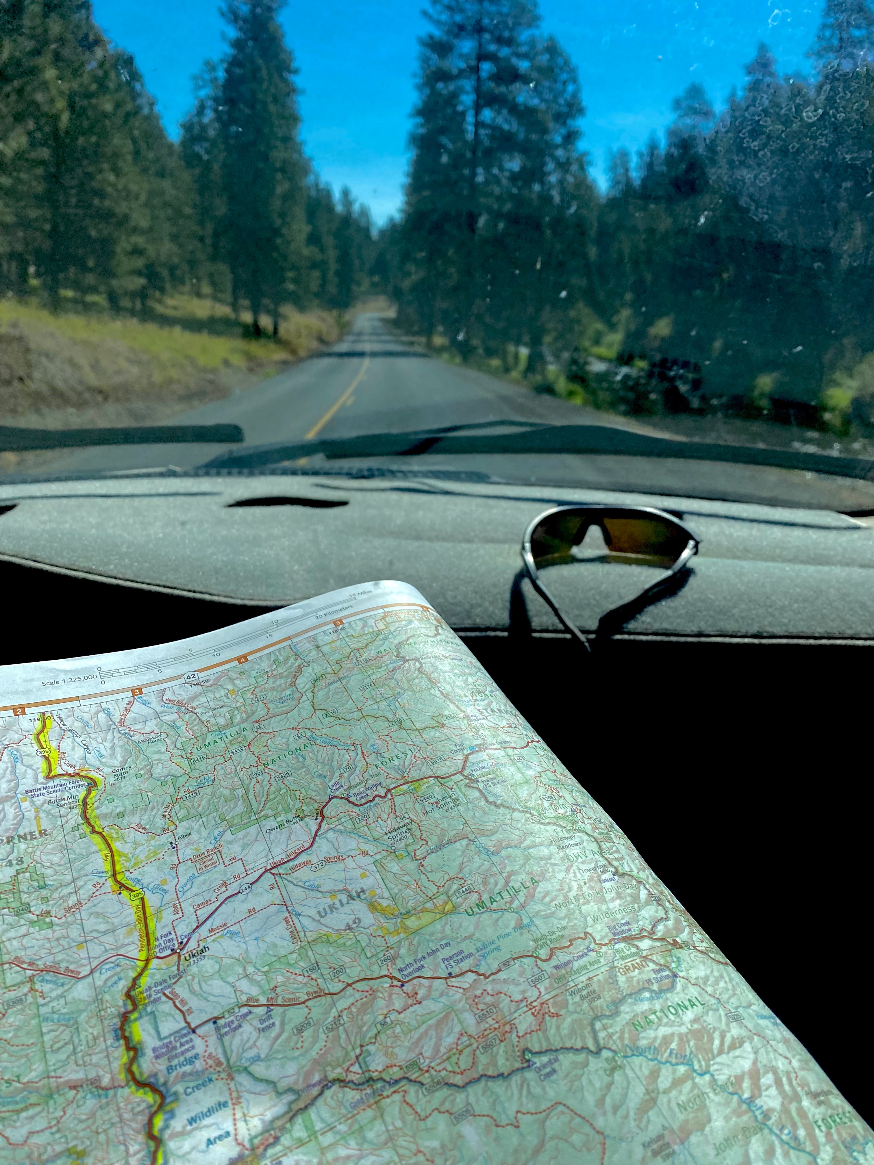
Don’t get me wrong, about my preference for paper maps—I’m still grateful that these days our phones can give us accurate driving directions. I appreciate the interactive nature of the traffic-warnings and road conditions (lots of mountain passes, in both states!), and I’m never more glad than when we’re navigating the hubbub of a hub like Portland or Seattle. But I still like to have that paper map open on my knee as we drive.
My very first highlighted map was a National Geographic political map of Europe, the summer of 1984. I was nine years old and my sister was six, and our parents took a six-month sabbatical to rent a violently-green VW bus and drive through 18 countries! We even went behind the Iron Curtain (East Germany, Poland, Czechoslavakia, Hungary, Yugoslavia), and gathered stamps in our passports from countries that don’t even exist anymore. Every evening the four of us sat down with the map, and a highlighter, and talked about where we had been that day, and highlighted our route.
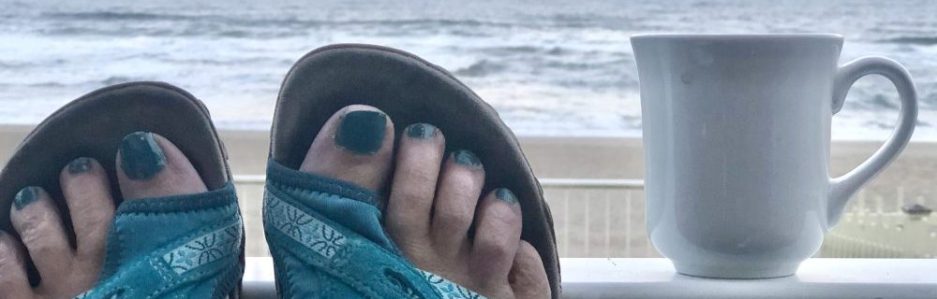
I’ve always assumed that my love of maps stemmed from my love of travel—but there’s also something about the maps and charts in their own right—something about the format that fascinates me. I pore over sailing charts even when our sailboat is anchored or moored. My National Geographic map of the Big Island has made several guest appearances on our couch in recent evenings, as we gear up (literally!—my snorkel-gear is already in my bag!) for our Hawai’i trip in a couple weeks. I should remember to pack a highlighter!
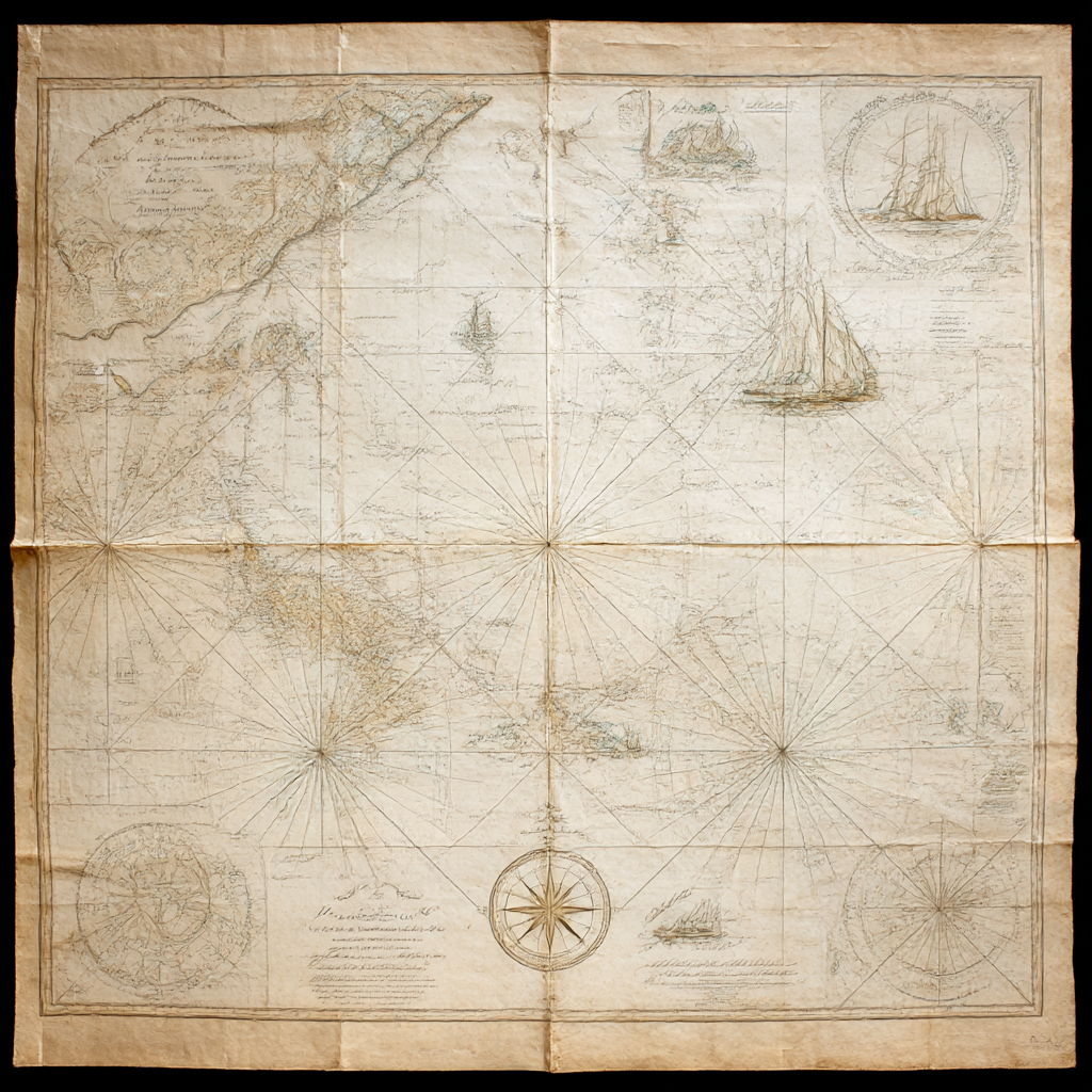
The wall of my office (my Hobbit Hole!) has a chart of the Pacific Ocean that dates from the 1840s—the decade when my fictional novel-characters are whaling in those waters. It is not an exact match to today’s maps—although the coastlines surveyed by Captain Cook haven’t altered much since he set them down. (He had his failings, but that man was a gifted cartographer!)
In his book MapHead, Ken Jennings (who apparently hosts Jeopardy! now) explores all the contours and landscapes of people’s relationships with maps—a book right up my alley! It happens that my favorite (living) Fantasy author, Brandon Sanderson, was Jennings’s college roommate, so what I remember most clearly from his book is the role that MAPS play in relation to fantasy fiction.

And after all, Bilbo Baggins kept Thror’s map, and hung it on his wall after his adventures—just like my map of Idaho.
I don’t imagine he owned a highlighter, though.
“Not all those who wander are lost.”
~J.R.R. Tolkien

I used to feel this way about maps and have owned a number of atlases in my life. My husband still complains about GPS and demands to have a paper map whenever we travel. Unfortunately, on the east coast, the roads change so often and so quickly, the maps can’t keep up LOL.
LikeLike
I love the fact that blogging is so international. (Something bloggers in smaller, local languages don’t get to experience.) I used to have penpals back in the day, and this somehow reminds me of that. I love knowing that the first spring bloom already happened in February in Scotland or that Slovenia has some cool hot springs that locals flock to.
Your blog map is very pretty, too. And I share some of your enthusiasm. I used to have a globe as a kid, which lit up and I loved examining it. I got an illustrated, explanatory world map for my kids’ bedroom wall very early on so they could get a grasp of the world, what is where. When I was in my twenties, I worked in the airline business, it was my dream back then. On my very first day in the office, what made the biggest impression on me was that the walls were covered with world maps with different colored pins indicating their own vs partner airlines’ hubs. It was just so exciting: the world at my fingertips!
LikeLike
What a fabulous, exciting job that must have been for a young person!
I enjoyed penpals as well, when I was a kid; I wrote for years to a girl in England, and for a year or so to a boy in Australia… Back in those pre-internet days, it felt pretty heady to correspond with someone in another country! ;)
LikeLiked by 1 person
Yes, it did!
LikeLike
Now I would like to see in what countries my blog is read, I also love maps and would love to have some hanging on my walls but Tim doesn’t
LikeLike
If you go to the “stats” section and then scroll down, you’ll see that list of countries. :)
LikeLike
I can relate with missing the widgets. I often find myself looking for methods to obtain older versions of different programs like Microsoft Movie Maker or Word 2010. Sometimes the newer versions are genuinely better but most of the time, it’s a lot of needless changes and removed features you really enjoy. Removed widgets especially reminds me of the Windows 7 interface. There were tons of free or cheap widgets you could install to your desktop that were a lot of fun and/or useful. But they did away with that because… “progress” I suppose.
I can also relate with the preference for the physical paper. I draw digitally almost exclusively now but nothing compares to the texture of real paper. A friend of mine got a special drawing pad screen cover that mimics paper texture and she’s told me it makes a big difference. It’s relatively cheap too, though I don’t recall off the top of my head what the brand was.
Maps in particular are especially cool because you can trace the chronology of an area with each version. I love writing timelines for different civilizations and getting into the details of how different landmarks change. I’d love to have an interactable map on a website for one of my fantasy settings where you can go back and forth in the chronology and watch as the biomes and structures change.
LikeLike
I’m really intrigued by the paper-texture screen cover! (I wonder if it would make my e-books feel more like “real” books too…)
What a great idea for an interactive map. Now THAT’s something an author of an e-book could incorporate! :D
LikeLike
Hello! It’s great to meet a kindred spirit who loves maps. I prefer paper maps too, Google and I have a love-hate relationship.
It’s good to be reminded that blogging is international and that people are reading my blogs and stories. Thank you for reading mine and subscribing 😊 you have inspired me to blog more often and longer, filling gaps with words. I was of the opinion that less was more, shorter attention spans, etc, as I’d read in an email about blogging. 🤷♀️ I found that off-putting. It’s time to expand!
Im glad to meet you and read your blogs!
Have an awesome day, from here in stormy SE Queensland. ⚡️⛈️💧
LikeLike
Bravo! If you have something longer in mind, WRITE it! I generally ignore those “rules for bloggers” that people put out there. (I’ve made some suggestions of my own, but those aren’t rules, either! ;)
LikeLike
I was hoping you’d include Tolkien. I’m in Australia and I think it’s cool that we can read something from the other side of the globe almost as soon as it’s written. It used to take weeks with real letters back in the day. I longed for a pen pal but had no idea how to set it up so I wrote to family members left behind in Wales. I was an avid letter writer. I miss that.
I love maps and charts and the way they bring places to life. There’s a young American guy, on instagram, who draws maps, over a hundred so far. He also makes stamps for map lovers who want to draw their own. His name on Insta is: Lord_ofmaps (Isaac Dushku) He also talks about the history of the places he maps which is always interesting.
I look forward to reading your blog each day. I struggle to keep a monthly blog going and am amazed that you write one daily.
I’m off to look for the Stats on my blog.
LikeLike
Oh wow, I’m looking up Isaac Dushku right now, thank you! :)
I won’t always post daily—I’m just on kind of a “writing kick” right now… So I’m riding it! ;)
LikeLiked by 1 person
Hello from your newest fan! I grew up in the world of Rand McNally maps and Fodor’s travel guides. It gave such an intimate look into each route. I didn’t have much of a sense of direction, but if I can visualize everything on a map, I was saved.
LikeLike
We still keep a road atlas in our car for our travels!
LikeLike
No highlighter? ;)
LikeLiked by 1 person
I remember that WordPress map where you could see what countries your readers are from. Why did they take that away? There was also some kind of plugin where you could highlight your own travels, I remember using it for a cross country trip. Reading your post makes me long for a beautiful map to hang on one of my walls (that desperately needs something). I think I am going to look into that. Thank you for the inspiration.
LikeLike
I love it!
LikeLiked by 1 person
Love Bilbo’s map.
LikeLike
I loved that map widget! I had a classroom blog the last couple of years that I was teaching (I retired in 2013), and the platform the school district provided was a WordPress platform. The kids loved to see who was reading the blog. And it amazes me as to how many people from around the world subscribe to my current blog. It truly is a world of its own.
LikeLiked by 1 person
I’m wondering, now, if we could get them to bring it back…
LikeLiked by 1 person
Kana,
Yep, I am also a ‘lover of the folded paper’. As a military officer I lived on and off maps for years. I was hiking the Appalachian Trail a number of years ago and a fellow hiker, a young sprout, was amazed that I carried maps of the trails and didn’t just pull up the trail on my cell phone. He was doubly amazed when I pulled out my daily ‘route card’ that had the day’s hike laid out and laminated. These cards had a map of the trail on one side and trail definitions (elevation changes, water sources, shelters, campsites etc. spelled out. I could look at the sheet and tell what was ahead of us. Each night I left that day’s card in the shelter trail-log book for someone heading south along the trail.
I had a young man asking me about using GPS in Vietnam. He was hiking with us on the Tuscarora Trail. I explained to him that the military didn’t get GPS until the mid-1980s and that at that time it was classified SECRET! It wasn’t until DESERT STORM that the media even found out how we were able to navigate in the desert so accurately. The young man was shocked when I told him about map reading in the Mekong Delta, Plain of Reeds. I told him how one of our officers screwed up with the map and compass and we ended up in a firefight inside of Cambodia. He wasn’t off by a lot, but just enough for us to nearly cause an international incident!
I still have a glove compartment full of driving maps and it’s amazing how many times I’ve pulled them out to plan a trip.
So put me down as a YES when it comes to maps!
Regards “Hardcharger”
LikeLike
Man after my own heart! :) Same when I’m sailing—although I like being able to double-check my work with the GPS. (Still, it’s always that way and not the other way around—I keep myself located on PAPER charts, because you never have a tech malfunction with a CHART!)
LikeLike